USGS Scans Percy Quin State Park Dam in Mississippi with LiDAR
864 views · Published 10 September 2012 · 0:27 · Indexed 27 September 2026
Channel: USGS · 2012 · Science & Technology
The U.S. Geological Survey is using LiDAR technology in select areas of Louisiana, Mississippi and Alabama to map areas impacted by Hurricane Isaac. Here, USGS scientist Toby Minear explains how USGS is helping the U.S. Army Corps of Engineers survey the impacts of high rainfall on Lake Tangipahoa at Percy Quin State Park in McComb, Mississippi, using LiDAR.

Videographer: Alex Demas, USGS
More from this channel
-
 2:47
Measuring Low Flow in San Pedro River
2:47
Measuring Low Flow in San Pedro River
-
 2:20
Streamflow Measurement, Pinto Creek, AZ (Jan 2010)
2:20
Streamflow Measurement, Pinto Creek, AZ (Jan 2010)
-
 5:05
Constrictor Snakes
5:05
Constrictor Snakes
-
 12:22
Why Some Public-Supply Wells are More Vulnerable to Contamination Than Others
12:22
Why Some Public-Supply Wells are More Vulnerable to Contamination Than Others
-
 0:26
Small Explosive Event in Halema`uma`u
0:26
Small Explosive Event in Halema`uma`u
-
 0:24
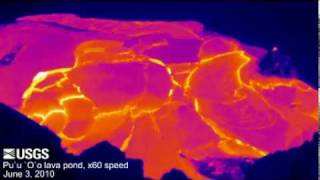
Thermal View of Active Lava Pond within Pu`u `Ö `ö
0:24
Thermal View of Active Lava Pond within Pu`u `Ö `ö
-
 1:06
High Flow on the North Fork Payette River, Idaho
1:06
High Flow on the North Fork Payette River, Idaho
-
 7:38
Indonesian Capacity Building in Seismology and Tsunami Detection
7:38
Indonesian Capacity Building in Seismology and Tsunami Detection