Standing Indian - Southern Nantahala Wilderness, NC
4,485 views · Published 29 June 2018 · 19:01 · Indexed 11 October 2026
Channel: Zachary Robbins · 2018 · Travel & Events
On Saturday, June 2, I did my first hike of two during the weekend to Standing Indian Mountain in the Southern Nantahala Wilderness of Nantahala National Forest. Since I had a long drive I didn't want a long hike, so I chose the Lower Trail Ridge Trail and Kimsey Creek Trail loop to summit the mountain. Beginning at the Standing Indian Campground I followed the Lower Trail Ridge Trail south into the wilderness. Although it was a combination of National Trails Day and the first decent weather in 2 weeks, I saw zero people on the ascent. The trail was lush with greenery, and had splendid 2nd-growth hardwood forests during the ascent. I was surprised how easy Lower Trail Ridge Trail was since the elevation change was over 2,000 feet. The trail was in excellent condition and never steep. This was one of the easiest hikes I've done with this mileage and elevation gain.

Just below Standing Indian at the Lower Trail Ridge - Appalachian Trail junction I encountered a huge group of high school backpackers, nearly 30 including their chaperones. They were nice but they may have been breaking wilderness regulations, unless there's an exception for the AT through the wilderness. They were at both of the main viewpoints talking, so I never did a proper overview of the vista. Standing Indian (5,499 feet) is the highest peak in the Nantahala Mountains and is the site of a former lookout tower. The view from the summit is fine but the view from some rocks 200 feet south is much better. (The forest fires of November 2016 enhanced these views.) From this perch you look out over the Tallulah River headwaters, Rabun Bald, Lake Chatuge, Boteler Peak, and the Fires Creek Rim. Afterwards, I checked out some of the western rock slides to get a nice view of the summit rim. From there the AT drops steadily to the Standing Indian Shelter and then Deep Gap, where I picked up the Kimsey Creek Trail. The creek and all tributaries were roaring, and the trail was a wet mess most of the hike. I probably would've enjoyed this section more if the creek was lower and it was possible to stand in the shoals and admire the creek without getting soaked.

Hike was 11.6 miles with 2,635 feet elevation gain in 5 hours and 50 minutes.

Hike location
https://goo.gl/maps/YozsWEzhhAJ2

Hike report
https://www.hikingupward.com/NNF/StandingIndian/
More from this channel
-
 5:28
Halo 1 Montage by RNX Part 2
5:28
Halo 1 Montage by RNX Part 2
-
 7:51
Halo 1 Montage by RNX
7:51
Halo 1 Montage by RNX
-
 9:45
Halo 1 Montage by RNX Part 1 Re-edit
9:45
Halo 1 Montage by RNX Part 1 Re-edit
-
 11:59
Halo 1 Nade Tricks by RNX - Hang 'em High
11:59
Halo 1 Nade Tricks by RNX - Hang 'em High
-
 12:41
Halo 1 Nade Tricks by RNX - Battle Creek & Damnation
12:41
Halo 1 Nade Tricks by RNX - Battle Creek & Damnation
-
 0:14
Upper Crabtree Falls - George Washington National Forest, VA
0:14
Upper Crabtree Falls - George Washington National Forest, VA
-
 0:19
Hanging Rock - Hanging Rock State Park, NC
0:19
Hanging Rock - Hanging Rock State Park, NC
-
 0:20
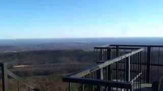
Moores Knob - Hanging Rock State Park, NC
0:20
Moores Knob - Hanging Rock State Park, NC