Chiapas Earthquake Mexico, 8.2 magnitude, first images, Gulf of Tehuantepec
2,930 views · Published 8 September 2017 · 0:58 · Indexed 22 October 2026
Channel: Cities of the World · 2017 · Travel & Events
On 7 September 2017, at approximately 11:49 p.m. local time, a magnitude 8.2[2] earthquake occurred off the coast of Chiapas, Mexico, approximately 87 kilometres (54 mi) south of Pijijiapan in the Gulf of Tehuantepec.[3] The earthquake caused some buildings in Mexico City to shake, prompting people to evacuate.[4] At least five people have been killed, according to the state governments of Chiapas and Tabasco.[5] The earthquake also generated a tsunami with waves of 1 metre (3 ft 3 in) above tide level;[6] tsunami alerts have been issued for surrounding areas.[7] It was the strongest earthquake recorded in Mexico since the devastating 1985 Mexico City earthquake,[8] as well as the second strongest recorded in the country's history, behind the magnitude 8.6 earthquake in 1787.[9] It is also the most intense recorded globally in 2017.[10]
On 6 September, several earthquake alarms in Mexico City were mistakenly activated and prompted the evacuation of buildings. The incident prompted a review of the system.[11]
Tectonic setting[edit]
The Gulf of Tehuantepec lies above the convergent boundary where the Cocos Plate is being subducted below the North American Plate at a rate of 6.4 cm/yr (2.5 in/yr).[12]
Earthquake[edit]
According to the National Seismological Service (SSN) of Mexico, the epicenter was located in the Gulf of Tehuantepec, about 137 kilometres (85 mi) southeast of Tonalá, Chiapas.[2] The United States Geological Survey (USGS) reported that the epicenter was about 87 kilometres (54 mi) southwest of Pijijiapan, Chiapas.[3] The SSN reported a measurement of M 8.4,[2] while the USGS reported a M 8.1 earthquake after correcting an earlier estimate of M 8.0.[3]
The earthquake is the most powerful to be measured in Mexico since the 1985 Mexico City earthquake,[13][14] and is comparable to the 1932 Jalisco earthquakes.[15]
Damage[edit]
Several homes in Chiapas have reportedly toppled or have been severely damaged by the earthquake; hospitals and schools were also damaged.[5] At least five people have died in the earthquake, including three in Chiapas and two in Tabasco.[5]
The earthquake also caused buildings to shake and sway in Mexico City, while also knocking out electricity.[5] There were reports of glasses shattered at Mexico City International Airport.[16]
The epicenter was near Mexico's border with Guatemala, where the quake was felt in Guatemala City, and infrastructure damage was reported by CONRED in the nation's south-west.[1] President Jimmy Morales claimed that one Guatemalan may have been killed.[17]
Tsunami[edit]
A tsunami with waves of 1 metre (3.3 ft) and higher was generated by the earthquake and was recorded at Salina Cruz.[6] The Pacific Tsunami Warning Center issued a warning for the entire Pacific coast of Central America, also extending south to Ecuador.[18]
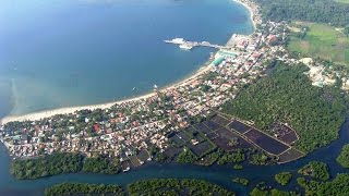
Mexico,before the 8.1 earthquake off the coast. hotels,travel,reserve,earthquake,8.1 earthquake,Mexico earthquake,Chiapas earthquake,Pijijiapan,Chiapas,Chiapas travel,Chiapas tourism,Chiapas nature,Chiapas tsunami,Pijijiapan travel,Pijijiapan tourism,Pijijiapan nature,Pijijiapan eartquake,Pijijiapan tsunami,Mexico travel,Mexico tourism,Mexico nature,Mexico eartquake,Mexico tsunami
More from this channel
-
 1:47
Woroneż to piękne miasto w Rosji, Woroneż rzeki Don, kolej,
-
 1:43
Sorsogon City, bandar indah Filipina, sebelum taufan Melor datang dengan angin, hujan dan banjir.
-
 2:17
Воронеж е красив град в Русия, River Воронеж, Don, железопътен,
-
 2:28
Bujumbura, hermosa ciudad en Burundi, en la orilla del lago Tanganyika, café, mineral de estaño,
-
 2:31
Bujumbura, no Burundi bela cidade, na margem do Lago Tanganyika, café,
-
 2:33
Бужумбура, красивый город в Бурунди, на берегу озера Танганьика, кофе, оловянной руды, медь
-
 2:56
الإسكندرية، مدينة جميلة في مصر، وعلى طول ساحل البحر الأبيض المتوسط، على دلتا النيل.
-
 2:59
Александрия, красивый город в Египте, на побережье Средиземного моря, в дельте Нила.