The Peak - Elk Knob Game Land, NC
2,199 views · Published 19 April 2018 · 8:13 · Indexed 11 October 2026
Channel: Zachary Robbins · 2018 · Travel & Events
***I tried a couple of changes from my usual format to align with what I consider generic YouTube videos. Really, my only changes are: 1) a video thumbnail with a caption compared to simply picking out the best pictures, 2) a quick video clip at the beginning instead of starting with the video title, and 3) shortening the length of the title screen and pictures by a second or more to hasten the transition between video clips.***

***I would appreciate comments/opinions on what you think about these subtle changes.***

Another fine day for peakbagging in the Amphibolite Mountains of the northwest corner of North Carolina. The Peak is the highest summit on a prominent ridgeline north of Elk Knob. This mountain divides the headwaters of the North Fork New River and the imposing Long Hope Creek Gorge, and is the high point of Ashe County. Although a few hundred feet shorter than the highest Amphibolites, the steep slopes rise more than 2,000 feet over the surrounding watersheds. The first half of the hike is a steep road walk, covering 2 miles and 1,200 feet elevation completely exposed to the sun. The road ends in a grassy saddle, and from there it is nearly 1.5 miles of bushwhacking along the mountain crest.

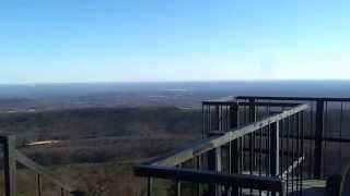
We reached the first major rock outcrops 1/3 mile from the saddle. In general, The Peak features steep forested eastern slopes and nearly vertical western slopes with lots of exposed rock. From most of these rocks we had great views south of Elk Knob and Snake Mountain, with Grandfather Mountain rising behind Pottertown Gap. Occasionally we would also see Old Field Bald and the Long Hope Creek Gorge. Further southwest were the Roan Highlands, and I believe Big Bald and the southern Bald Mtns were visible. A very faint path sometimes followed the top of the mountain, and was flagged. The toughest part of the hike was after the saddle below the twin summits. The climb to the southern false summit was steep, but rewards you with multiple cliff views around the top. After the false summit any semblance of a route disappears, and we had to bushwhack a few hundred yards up slopes to the forested summit of The Peak (5,214 feet). There were some cliffs near the summit where we took a break and got better views north of the Iron Mountains around the tri-state border. After this hike I only have one more 5,000-ft peak in the Amphibolites left.

Hike was 6.4 miles with 2,277 feet elevation gain in 4 hours.

Hike location
https://goo.gl/maps/A58mASWK9QB2
More from this channel
-
 5:28
Halo 1 Montage by RNX Part 2
5:28
Halo 1 Montage by RNX Part 2
-
 7:51
Halo 1 Montage by RNX
7:51
Halo 1 Montage by RNX
-
 9:45
Halo 1 Montage by RNX Part 1 Re-edit
9:45
Halo 1 Montage by RNX Part 1 Re-edit
-
 11:59
Halo 1 Nade Tricks by RNX - Hang 'em High
11:59
Halo 1 Nade Tricks by RNX - Hang 'em High
-
 12:41
Halo 1 Nade Tricks by RNX - Battle Creek & Damnation
12:41
Halo 1 Nade Tricks by RNX - Battle Creek & Damnation
-
 0:14
Upper Crabtree Falls - George Washington National Forest, VA
0:14
Upper Crabtree Falls - George Washington National Forest, VA
-
 0:19
Hanging Rock - Hanging Rock State Park, NC
0:19
Hanging Rock - Hanging Rock State Park, NC
-
 0:20
Moores Knob - Hanging Rock State Park, NC
0:20
Moores Knob - Hanging Rock State Park, NC