Kitsuma Peak and Point Lookout - Pisgah National Forest, NC
1,037 views · Published 8 February 2018 · 20:40 · Indexed 11 October 2026
Channel: Zachary Robbins · 2018 · Travel & Events
A leisurely hike on the popular Youngs Ridge Trail and Point Lookout Trail loop. I've passed by these trails a lot on I-40, and finally decided to check it out. The two trails circumnavigate the Royal Gorge of Swannanoa Creek, sandwiched between Old Fort and Black Mountain. I started at the Old Fort Picnic Area on the Youngs Ridge Trail. This is your best option for hiking since it gets almost all of the climbing out of the way in the first 4 miles, and it is in the opposite direction of most mountain bikers. You'll be able to spot them up ahead zooming down the ridge towards you.

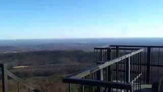
Youngs Ridge parallels I-40 as it climbs from Old Fort to the Eastern Continental Divide. Despite the low elevation of the ridge I found it to be scenic, with constant winter views on either side. There is a nice cliff overlook less than 100 yards below the wooded summit of Kitsuma Peak (3,195 feet). I-40 cuts west through the Swannanoa Valley. The Swannanoa Mountains rise southwest. The peaks around Montreat and Ridgecrest are mostly visible, including Lookout Mountain, Graybeard Mountain, Pinnacle, and Clingmans Peak. The trail descends on many switchbacks down to Swannanoa Gap, then parallels I-40. After the trail ends, I followed Royal Gorge Rd then Mill Creek Rd to start the Point Lookout Trail.

The Point Lookout Trail is a paved path that follows the former route of U.S. 70 through the Royal Gorge of Swannanoa Creek. This is a popular trail for exercise and bikers. It gradually winds along the shoulder of Bernard Mountain, providing many views of Youngs Ridge towering above the gorge. You'll also parallel the railroad for the first mile as it cuts through the mountains. One section allows you to see two tunnels, and then the railroad disappears. Point Lookout is a nice overlook east through the exit of the gorge, with views of the South Mountains in the distance. The trail drops below the point providing a few more nice views before ending close to the picnic area. A great change-up from my usual type of hike.

Hike was 10.2 miles in 4 hours and 30 minutes.

Hike location
https://goo.gl/maps/Ycq2BT2mM1CmbSL58

Hike report
https://www.hikingupward.com/PNF/KitsumaPeakPointLookout/
More from this channel
-
 5:28
Halo 1 Montage by RNX Part 2
5:28
Halo 1 Montage by RNX Part 2
-
 7:51
Halo 1 Montage by RNX
7:51
Halo 1 Montage by RNX
-
 9:45
Halo 1 Montage by RNX Part 1 Re-edit
9:45
Halo 1 Montage by RNX Part 1 Re-edit
-
 11:59
Halo 1 Nade Tricks by RNX - Hang 'em High
11:59
Halo 1 Nade Tricks by RNX - Hang 'em High
-
 12:41
Halo 1 Nade Tricks by RNX - Battle Creek & Damnation
12:41
Halo 1 Nade Tricks by RNX - Battle Creek & Damnation
-
 0:14
Upper Crabtree Falls - George Washington National Forest, VA
0:14
Upper Crabtree Falls - George Washington National Forest, VA
-
 0:19
Hanging Rock - Hanging Rock State Park, NC
0:19
Hanging Rock - Hanging Rock State Park, NC
-
 0:20
Moores Knob - Hanging Rock State Park, NC
0:20
Moores Knob - Hanging Rock State Park, NC