Tropical Update & General Weather with J7409 Wed June13,2018
2,265 views · Published 13 June 2018 · 16:09 · Indexed 13 October 2026
Channel: J7409 · 2018 · Science & Technology
Tropical Update & General Weather with J7409 Wed. 6-13-18
watch  https://www.youtube.com/user/J7409

Weather In General for the U.S.....
Moisture from Hurricane Bud is making its way northward through
Western Mexico. Portions of southern Arizona will begin to have rain
associated with this tropical system by Thursday, with more coverage by
Friday..Scattered showers and thunderstorms will persisted across much of the
Central Plains, the Deep South and the Ohio Valley ahead of a frontal
boundary tracking slowly to the east. This boundary will provide a focus
for heavier rainfall and strong to severe thunderstorms, particularly
across portions of the lower Ohio Valley and the Central Plains. Slow
storm movement will increase the threat for heavy rainfall and flooding.
A frontal system will cross through the Rockies and exit into the Northern
High Plains over the next few days which will provide focus for strong
convection across the Northern Plains.much of North Dakota and western Minnesota in a slight risk with an
enhanced risk over central North Dakota through Friday. Persistent ridging in the upper levels will keep summer heat locked in
across the Southwest with afternoon highs in the 90s and low 100s likely
through Wednesday
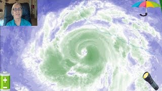
HurricBud is forecast to accelerate northward late Thursday into Friday.
On the forecast track, the center of Bud will cross southern Baja
California Sur early Friday and move over the Gulf of California
later on Friday.

Maximum sustained winds have decreased to near 75 mph (120 km/h)
with higher gusts.  Additional weakening is forecast, and Bud is
expected to become a tropical storm later today.  Bud is forecast to
still be a tropical storm when it reaches southern Baja California
Sur late Thursday or Thursday night.

Hurricane-force winds extend outward up to 25 miles (35 km) from the
center and tropical-storm-force winds extend outward up to 105 miles
(165 km).
Tropical storm conditions are possible within the watch
area beginning on Thursday.

RAINFALL:  Bud is expected to produce additional rainfall of 2 to 4
inches across much of southwestern Mexico through Thursday, with
isolated maximum amounts of 6 inches.  These rains could cause
life-threatening flash floods and mud slides.

Bud is also expected to produce 1 to 3 inches of rain with isolated
totals of 5 inches across southern portions of Baja California Sur
and Sonora in northwestern Mexico through Saturday.

SURF:  Swells generated by Bud will affect portions of the coast of
southwestern Mexico, western mainland Mexico, and the southern Baja
California Peninsula during the next few days.  These swells are
likely to cause life-threatening surf and rip current conditions.

If You Would like
 to donate for my work click the link below. Thank You.
Click the link below , it will take you to my channel, then click the PayPal button in the upper right corner and it will take you to donation page.  Thanks Again so very much.
https://www.youtube.com/user/J7409


For Weather News Forecast Subscribe Here......  https://goo.gl/Nw3hY2


If You Really want to GROW your channel Sign up and download tubebuddy. Its legal and made to work with youtube. Check it out! Its great. Link Below

https://www.tubebuddy.com/J7409

Send me pictures of bad wild, weather. or any interesting and different pics you want to share. below is the e mail addy to send them to.

[email protected]
More from this channel
-
 13:20
Weather News With J7409 Sunday 6- 3 -18
-
 5:46
Weather News Today with J7409 June 5,2018
-
 8:07
Weather Alert Tornado Watches and More are up June 9 2018
-
 5:41
Weather News Today With J7409 Sunday June10,2018
-
 8:50
Weather News Today with J7409 Monday 6- 11- 18
-
 12:03
Tropical Update We Have an X Monday Afternoon 6 -11- 18
-
 8:50
1 SYSTEM Is Growing,, Tropical Update with J7409
-
 10:44
Tropical Update Invest 91L & Tropical Storm Carlotta with J7409 6 15 18